Saturday, August 3, 2013

MD HEAT Race - Aug 3, 2013

View Dave Races the Trails in a larger map

The night before the race was a very short one. I was up until 1:30 doing laundry and getting stuff ready for the weekend. My original plan was to head directly to a family reunion in Northfield, NJ after the race. I got up at 4:30 because the race director wanted everyone at the parking area by 7 am. I got there by 7 and then ended up waiting for almost 2 hours after the shuttle bus ride into the park for the race to begin. If I had it to do over again I would have slept in for at least another hour.

The weather cooperated, to a degree. It rained, off and on. There were no torrential downpours but it was a soggy day. The rain helped to keep me cool and minimized my need for re-hydration. I took a rain jacket with me but I didn't wear it. It sat in the bottom of the bag I carried with me during the race.

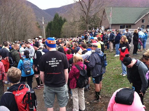
It wasn't a very big field of participants, only a handful of them started the race walking. I walked with one of the few until we reached the first hill. At that point we caught up to another walker and I left them behind.

I passed a couple more people before reaching aid station 1, near the 4 mile mark. I paused long enough to grab a handful of trail mix. I passed a couple more people there and a bunch more on a very steep and rocky descent less than a mile after aid station 1.

One thing I had working in my favor was my fearlessness of water. As with the rocky downhills I didn't slowdown when I encountered streams. I didn't go to any sort of lengths to try and keep my feet or my boots dry. When I reached the river crossing I just powered through it. I took a few items out of cargo pockets and held them in my hands but unlike the half-dozen or so runners that I passed at that point I didn't take the time to take off my shoes and socks before crossing. The water was up to mid-thigh on me, at the deepest point. My boots were full of water when I got out of the river. I'm not sure how long it took for the bulk of the water to drain but eventually they didn't seem quite so water-logged.

When I got to aid station 2 one of the volunteers asked me how I was doing and offered me a choice: stop or turn uphill and keep going. I chose to keep going. I passed a trio of women at that point for the second of three times. They would eventually pass me again just before aid station 3 and then pass me a little after it. I passed three other people between aid stations 2 and 3, who did not return the favor.

I pushed myself a little too hard on the rocky downhills in the first half of the race. I took it a little easier after that because my left hip was starting to bother me.

At aid station 1 I grabbed a handful of trail mix and kept going. I didn't stop at aid station 2. I stopped for a minute or more at aid station 3 to down a small peanut butter sandwich and a small cup of Gatorade. In between aid stations I also nibbled at the food I brought with me (hard pretzels, raisins and almonds) and drank some water.

I had been to various parts of Patpsco Valley State Park before, for Quantico Orienteering Club. Some of the trails that the race course traveled were familiar to me but most of them were in the last 6-7 miles of the race. It felt a little weird sticking to the trail and not following other handrail features.

Early on I could see that I was close to a 18 minutes/mile pace. I pushed myself in an effort to increase my average pace to 17:06 but I never got there and eventually gave up on that goal as the pain in my hip got worse.

On the whole I thought the organizer did a very good job but that doesn't mean that there isn't room for improvement. I was annoyed that the race didn't start on time. It was scheduled to begin at 9 but didn't step off until 9:20. Also would have been nice if the race course had been just a little bit longer. According to my Garmin it was 15.3 miles or 24.6 km, even though it was billed as being a 25 km race. Nitpicking? Possibly, but that's how I feel.

After the race there was free food. I ate a foot-long hot dog (that I broke in two and split between two regular-sized hot dog rolls) and a piece of chocolate cake. I hung out for a little while after that until the shuttle bus back to the parking area arrived. I considered briefly sticking with my original plan and driving straight to the family reunion in New Jersey, after changing my clothes. After assessing how sweaty and muddy I was I decided to drive home and clean up before heading to the family reunion.

MD HEAT Race 2013

Time: 4:34:30
Pace: 17:56 / mile
Place: 155/180 (Overall), 29/31 (M 40-49)

Results: UltraSignUp

Sunday, July 14, 2013

French Creek East - Jul 14, 2013


View Dave Goes Orienteering 2012-13 in a larger map

I drove up the day before the meet and camped in French Creek State Park. My camping gear consisted of a 2-person tent and a bed roll that I bought from REI in early June. It took me a half hour to get the tent set up. The instructions on the bag were clear enough, but it took me a little while to figure out what was what. It took me almost as long to break the tent down on Sunday morning.

I had originally intended to stop in Lancaster for dinner on Saturday night but it was only 4:30 when I reached Lancaster and I wasn't very hungry so I kept driving. I ended up dining on a kashi bar and a mix of almonds and raisins on Saturday night. For breakfast the next morning I had some fresh fruit (that I bought at Whole Foods on Saturday), some more almonds and raisins, and a blueberry flavored pro bar.

Early Arrival, Late Start

I arrived early (9:20) and expected to be one of the first people to start. Unfortunately the meet director was a little overwhelmed and short on help so everything was not ready to go at 10 when the meet was supposed to begin. I helped carry some gear from the parking area up to the registration area, a couple hundred yards away. After that I stood around and waited for a while.

More and more people started to show up and things weren't ready to go. The e-punch set up was still in the process of getting set up when the meet director asked if someone would carry 3 gallons of water up to the start, which was a good kilometer or more uphill from the registration area. Nobody responded to his request so I picked up the box and lugged it up to the start.

Slow Start, Small Map

I expected that after I got to the start I would have to turn around, go back to the registration area, and register my e-punch. Instead they told me I could go ahead and start. I was a bit out of breath and sweating profusely but I accepted the challenge. My eyes almost popped out of my head when they handed me the map. It was tiny, considering the area it covered. the contour lines were printed in yellow and hard to read.

It took me a minute to get my bearings and figure out in which direction I need to head in order to find the first control. It took me about 15 minutes to find it, even though it wasn't very far from the start.

It took me over 30 minutes to find the second control. My search for it began with much bushwhacking. Once I got though all the under growth and out on a trail I thought I was in good shape. I would have been if I hadn't mistaken one trail junction for another and turned off onto a trail that didn't lead me where I needed to go. Once i figured out what I had done wrong, which took a while, I was able to find the control 2/77 without too much trouble.

The next 9 controls (3 through 11) didn't give me any trouble at all. I used my compass quite a bit while searching for them. I was most concerned when looking for 3/xx because other than having a bearing I wasn't sure what terrain features to look for. I followed the bearing and nailed the control. I didn't nail all the other controls I found but once I got close enough and was in the area of them by looking around me I was able to spot them once I got close enough.

I was sold on the compass approach after finding the first 11 controls. I tried using that approach for the 12th one and wound up in a sea of thorns. I kept pressing through the thorns until it got so bad that I had to turn back and find the nearest trail. I spent a long time amid the thorns. I didn't think they would be that thick or last for that long. Even after I turned back and started heading for a trail it took me a long time to get free of the thorns.

I did not emerge from the thorns unscathed. I came home with with many scrapes and cuts on my legs and arms. In some places there are so many marks from the thorns that it looks like I have lots of new freckles. I spent a little bit of time looking for 12, unsuccessfully. I was starting to run short on time and eventually I gave up.

I had a long walk back to the finish. It gave me plenty of time to contemplate my decision to attempt the red course. I was torn between the green and red courses. I had my doubts about my ability to finish the red. I definitely overreached. Under better circumstances I might have finished the red course successfully.

Course: Red [18 controls; 7.1 km; 205m]
Time: 3:24:49
DNF (gave up after finding the first 11 controls)
Actual Distance: 10.3 km / 6.4 miles


Monday, May 27, 2013

Hickory Hop 6 Hr Rogaine - May 26, 2013


View Dave Goes Orienteering 2012-13 in a larger map

Pre-Rogaine

I drove down with Dan and Jon the night before. We stopped at a Thai restaurant (Bangkok 56) in Harrisburg for dinner. We arrived at Camp Shehaqua after dark. We stayed the night in a small cabin. It was much colder that night than I thought it was going to be. The cabin was not heated and the "mattresses" were just plywood boards. I didn't bring anything with me other than a twin-size comforter and and a pillow.

The temperature dropped down into the low-40s, I'm guessing. I slept fully dressed under the comforter. I did my best to stay under the comforter but I woke up on a number of occasions to find that my nose was cold because it was sticking out into the cold night air. I have no idea how long I slept. I know that I was awake for long periods of time. I must have slept some because I was not dead-on-my-feet the next day and I have a vague memory of at least one dream.


6-hour Rogaine

I got off to a decent start (by my standards) but lost a lot of time (1:37:03 by my estimate) looking for two controls that I never found. Best case scenario I might have scored a couple hundred more points than I actually did. I am satisfied with my performance considering that it was my first 6-hour rogaine.

Map A

My initial strategy was to get all the controls in one section of the map. I started with the eastern section of the map. First I swept south and then east. It took me 21 minutes to find the first three controls (63, 75, 65) as I swept south. It took me 29 minutes to find the eastern-most control on the map (35). In retrospect, considering how few points it was worth and the amount of time I spent looking for it I probably should have skipped it and headed west instead after finding 65.

The next three controls (45, 77, 67) challenged me but I found them all. I was unable to find the 8th control (47) I looked for. I circled around in the general vicinity of it, probably passed close to it, but never found it. In retrospect I am torn as to whether I should have skipped it altogether or just approached it from a different angle. I spent almost 55 minutes looking for it.

Having found (or at least looked) for all the controls in the eastern section of the map. I didn't have a plan of attack for this portion other than to wrap it up by getting the controls closest to the finish. I found the first control (73) I searched for in the western portion of the map without too much trouble.

At that point I probably should have reversed course and headed back to the trail I left when I was approaching 73. Instead I did much fruitless bushwhacking in an attempt to find 61. I finally gave up on finding it after 43 minutes. At that point I was getting frustrated. In a little over two hours since finding 67 I had only found one more control, 73.

Having a little less than an hour and 45 minutes to go I decided to play it safe and look for the low hanging fruit. I found 31 without too much trouble. I probably played it a little safer than I otherwise might have due to my experiences with 61 and 47.

I made a colossal mistake when it came to finding the next control (53): I headed south when I should have headed north. Not only did I head in the wrong direction but I ignored two clear indications that I was headed the wrong way: I crossed a creek that shouldn't have been there and I didn't cross a string telephone poles. It wasn't until I got back to a control I been to before I that I realized I was headed in the wrong direction. I probably lost 20 minutes thanks to his mistake.

I found the last two controls (53, 51) that I looked for without too much trouble. I got back to the finish with a little over 15 minutes to spare.

Map B

The only control I found on this map (80) was 50 feet from the finish.

Post-Rogaine

We hung around for almost two hours after the rogaine. There was food and an awards ceremony. Jon finished in first place. No one found all of the controls, Jon came closest (47/50). All participants received a commemorative towel.

We stopped on the way back for dinner at an Indian restaurant (Taste of India) in Harrisburg.

I was determined to make it as far as I could on the drive back without refueling. I almost made it to the gas station I intended to stop at when my car ran out of gas. Lucky for me I was able to coast downhill to the gas station.

Course

The distance is the straight line distance of the route I walked, jogged, and crawled. I included the controls in the measurement. I only searched for 14 of 50 controls.

Course: 6 Hr Rogaine [14 controls; 8.1 km]
Score: 715 points (Map A: 635; Map B: 80)
Time: 5:43:29 - Results
Actuals: 14.81 (distance); 415 (climb)

Mason Neck - May 19, 2013


View Dave Goes Orienteering 2012-13 in a larger map

The weather was warm but nice at Mason Neck. I was supposed to volunteer but I was relieved of that duty earlier than expected because of the low initial turnout. Because I had a lot of time on my hands I decided to try the blue course, even though I was warned that it was long and difficult. For the most part I didn't find it to be too difficult, but I had enough trouble finding two of the controls to cause me to decide to skip a couple of the controls.

Finding 3/125

Traveling from the 2/108 to 3/125 was a bit of trial for me. The straight line distance according to the map is roughly 1.73 km (1.1 miles). I walked in circles and squares, up down and all around before I finally found it. According to my Garmin I walked 6.9 km (4.3 miles) from 2/108 to 3/125. It took me 1:49:50 to cover that distance. That's almost half of the distance and half the time that I spent on the blue course.

My initial mistake was not traveling far enough to the east. I was headed towards the control but the lack of terrain features made it difficult for me to tell if I had gone far enough. I thought I had overshot the control so I circled around and headed back the way I came. When that didn't work I assumed that I was too far to the south so I headed north. I wandered here and there. Eventually I wound up back at the road. By then I had been walking for 1:22:35 (since leaving 2/108) and covered 3 miles.

I was about ready to give up at that point. Then I recalled a handrail that I used the last time I was at Mason Neck, a line of old telephone poles. They seemed to lead almost directly to 4/126 which wasn't too far from 3/125. I followed a trail to the line of poles and approximately 28 minutes and 1.3 miles later I found 3/125.


Finding 11/124

I didn't have much trouble finding the next 4 controls. After reaching 8/122 I decided to skip 9/129 and 10/130. Doing so cut almost 2 km out of the remainder of the course. Instead I headed for 11/124. According to the map it looked like I needed to head north northeast, which according to my Garmin I did.

When I didn't find it I assumed that I might have headed northeast instead of north northeast. So I turned west for about 50 meters and then proceeded to head south southwest. Still no success. I was about ready to give up at this point. I started to head northwest toward the road. I hadn't gone too far when I spotted a couple people 100 meters away to my right. They were standing right on 11/124.

In looking at my track after I got home it looks like 11/124 was actually due north of 8/122. I'm not sure if the problem is with the map or the placement of the control but I feel somewhat vindicated in that at least this time I adopted a sound approach based on the information I had. The straight line distance from 8/122 to 11/124 according to the map was 0.43 km (0.26 miles). I ended up walking 1.45 km (0.90 miles) in 29:43 before I found it.


I was running out of time quickly but I decided to try and find the remaining 4 controls, which I did with out much trouble. It is difficult to say if I would have had much trouble in finding 9/129 and 10/130 if I had looked for them. I like to think that I would have found them with out much trouble because both controls are close to the line of telephone poles that I used when I was searching for 3/125.


Thumb Compass

I used a thumb compass (left-handed) for the first time at Mason Neck. I borrowed it from the course setter. A few days prior to Mason Neck I watched an instructional video on thumb compasses on YouTube  As with most things I needed more than just instruction to make the leap from using a baseplate compass to a thumb compass; I needed practical experience.

I wasn't entirely successful when it came to holding the map and compass in the same hand. Turning the map to line it up with the compass in theory should have been fairly simple but for some reason it was a difficult adjustment for me to make.

I also had to be careful about how I held the compass. I occasionally caught myself drifting to the left of the direction I wanted to head because I wasn't holding the compass directly in front of my body.

The biggest advantage I found to using the thumb compass was the speed and ease with which I could check the direction I was headed.


Blue Course (Modified)

Because it took me too long to find 3/125 I skipped 9/129 and 10/130. By my calculations that shortened the course from 9.3 km to 7.4 km.

Skipped: 8 - 9 (1100 m); 9 - 10 (250 m); 10 - 11 (940 m)
Added: 8 - 11 (430 m)
Net Change: 430 - 2290 = -1860
Adjusted Total Distance: 9.3 km - 1.86 km = 7.44 km

Course: Blue Modified [13 controls; 7.4 km; 210 m]
Time: 3:58:14 - AttackPoint - WinSplits
Actuals: 14.97 km (distance); 303 m (climb)
Track: Garmin Adventures


Friday, May 17, 2013

Pohick Bay - May 5, 2013


View Dave Goes Orienteering 2012-13 in a larger map

This was a good challenging course in both physical and navigational terms. The weather was warm but not excessively hot. I found myself a bit distracted by other orienteers, usually ones not doing the same course as I. I'm certain this cost me some time in the case of the 1/124.

There were a few other controls that gave me some trouble. I got some help from other orienteers in finding 7/105. I descended what I thought was the re-entrant where the control was placed, but it wasn't there. I had a number of people pass me at the bottom of the re-entrant headed to the north, towards the bottom of another re-entrant. I'm pretty sure that one of those re-entrants is not mapped.

There was a lot of ground to cover from 18/144 to 19/149. The most direct route didn't look like the sensible route. I took a trail that skirted the coast as far as I could before I started cutting cross-country through an area that looked much worse on the map than it turned out to be in reality. I passed 19 on my first attempt to find it. I was too high up on the hillside. It was hidden from my view on that first pass, but I found it fairly easily on my second attempt. I would have found it faster if I had not overshot it by quite so much.

The next three controls, (20/148, 21/147, 22/143) weren't difficult to find but there were some steep ascents and descents to navigate before I reached them.

Course: Blue [23 controls; 8.9 km; 575 m]
Time: 3:22:10 - AttackPoint - WinSplits
Actuals: 12.26 km (distance); 308 m (climb)


Sunday, May 5, 2013

Patapsco/Rockburn Branch - Apr 28, 2013


View Dave Goes Orienteering 2012-13 in a larger map

Under normal circumstances I would have done the blue course. My right hip was bothering me a little bit so I opted to do red instead. My hip is now feeling better than it was before orienteering but not all better.

The most notable thing about this orienteering excursion is the regularity with which I kept encountering the same JROTC student. He was also doing the red course. He caught up to me between the 4th and 5th controls. He was with me, either just behind or just ahead of me while I searched for 5, 6, and 7. I took a different route and got to the 8 before he did.

He passed me on the way to 9 but overshot the control. I saw him when I was on my way to 10 and pointed him in the correct direction. He caught up and passed me on the way to 11. We both fumbled around on the way to 12 but found it around the same time. I caught up to him at 13, where he was drinking some water. He was with me for 14 and 15. After 15 he took off in the right direction while I decided to take a less direct route to 16. I didn't see him again until after I finished the course.


Course: Red [19 controls; 7.0 km; 250 m]
Time: 2:15:12 - AttackPoint - Winsplits
Actual Distance: 9.48 km / 5.89 miles

Sunday, April 21, 2013

25K Hyner View Trail Challenge - Apr 20, 2013


View 2013 - 25K HVTC in a larger map

I started near the back of the pack, which may have been a mistake and certainly cost me some time. There was one choke point early in the race, where we left the road and hit the trails. The people I was bunched up with were extremely cautious along the trail. It wasn't until we got to the bottom of the first hill that I was able to start passing people.

Williamsport 2

I was checking my time pretty carefully throughout the race. I completed the first mile, which was before we hit the trail head, in 17 minutes. The second mile, which ended near the bottom of first hill, took me 27 minutes to complete, thanks to the bunching on the narrow trail.

Humble Hill, the first part of the first hill, was extremely steep. I was moving faster than most people were and there were lots of opportunities to pass that I took advantage of. After Humble Hill it leveled off briefly but then it was all uphill to Hyner View which is also used as a launch point for hang gliders. The last few hundred meters to the peak were once again very steep.


Hyner View 1 Hyner View 2

There was an aid station at the top. I walked right past it and headed down the backside of the hill. I was concerned about my time. I had goals in mind and I felt that I needed to pick up the pace so I shuffled most of the way down the backside of the first hill. I slowed a couple times to eat a little bit of a pro bar and drink a little bit of the water I brought with me.

The second hill was long but nowhere near as steep as the first. The route to the top of the second hill was along Johnson Run. The trail crossed back and forth over the stream twenty or more times. A lot of the people ahead of me were very tentative about crossing. For the most part the water wasn't more than ankle deep. I got impatient and started going around groups of people crossing wherever it seemed like I could. My feet got wet; I didn't really care. I wanted to maintain a good pace.

I passed more people along Johnson Run than I did anywhere else. Even climbing up the last bit to the top of the second hill I passed a lot of people who were just moving too slow for me. I would run briefly to get ahead of them and then resume walking.

I went right past the second aid station and started down the other side of the hill, Post Draft. I paused briefly for a few more bites of pro bar and sips of water. The path was very narrow after a point, which made it difficult for me to pass people. I wound up behind a small group of people who were moving slower than I wanted to move. I stayed behind them until a couple runners came through and asked to pass. I followed in their wake past the people I had been stuck behind. I did this a couple more times down to the bottom of Post Draft and leading up to the third and final hill.

The path along Cleveland Hollow, the first part of the final hill was steep and I didn't think I was moving all that fast. Still, I passed a number of people on the way to the top. It wasn't as long as the previous two hills but the final few hundred meters (aka SOB) were extremely steep. For the first time I considered pausing to catch my breath. I didn't stop until I got the top but I was moving much slower than I had been by the time I got there.

At the top, I stopped at the third and final aid station. It was snowing lightly. I drank a couple cups of water, ate some trail mix, and caught my breath. After about five minutes I moved on. There was a little more uphill but it wasn't very steep.

Spring Trail 2 Spring Trail 1

The hardest part for me of the remaining 5 miles was the long downhill along Huff Run. For the most part it wasn't very steep but my left knee was starting to bother me. I walked the whole way down. I would have liked to shuffle down and pick up some more speed but my knee just wasn't having it. I got passed by a number of people, who were running, on the way down. Many of them were people I had passed on the way up Cleveland Hollow or earlier in the race.

The last mile was all along roads. I quick marched the whole way. I broke into a jog right at the end. I passed a few people and was passed by a few others in that final stretch. There was a big crowd at the finish line cheering people on as they crossed. I received a medal for finishing and then went to grab a bite to eat.

They had barbecue chicken, hot dogs, baked beans, potato salad, pizza, and desserts. I got a huge piece of barbecue chicken and some potato salad. There were a number of beverage options. I passed on the beer and stuck with water.

Originally I was hoping I would have a good enough time (4 hrs 30 min) to qualify me to participate in next year's 50K. As I walked and occasionally ran, it became clear to me that I wasn't moving fast enough to hit that mark. My secondary goal was to finish with an average pace of 3 mph, which I calculated would mean completing the course in 5 hrs 15 min. I just made that mark; my official time was 5:14:35. What I didn't realize is that the 25K race was actually about a half mile longer than 25K, so I did better than just squeak under the wire of my secondary goal.

This race was not easy in the least bit. It was fun and challenging. I didn't push myself to the very edge of my physical limits but I was worn out and very hungry by the time I finished. I think I would need to be in better shape, take it easier, and eat more during the race in order to complete a 50K of this magnitude of difficulty.

Time: 5:14:35
Pace: 18:57 / mile
Place: 601/958 (Overall), 114/161 (M 40-49)

Results: PA Runners

Thursday, April 18, 2013

Combat Village - Apr 14, 2013


View Dave Goes Orienteering 2012-13 in a larger map

The weather was great but my luck wasn't. I got off to a shaky start and things just got worse from there. If I could have had another hour then I might have been able to finish the blue course but by the time I threw in the towel I knew time was running short and the responsible thing to do was admit defeat.

I had a little bit of trouble finding the second control. I thought I was headed right towards it but when I wasn't able to find it on the first attempt I started to head south toward road. Before I reached the road I spotted it.


My trip from the 2nd to the 3rd control was a catastrophe, even though I eventually did find the 3rd control. On the first attempt I left the road in the wrong place. I ended up wandering around in the wrong part of the course for a while before heading back to the road. On the second attempt I found it within a few minutes. If I had just taken a little more time figuring out where to leave the road the first time around it might not have taken me 53+ minutes to find the 3rd control.


I didn't have quite as much trouble finding the 5th control. I think my confidence was still a bit wobbly after my experience with the 3rd control.


I wish I had a good explanation for why it took me so long to find the 9th control. After 5 I found 6, 7, and 8 without any trouble. From 8 to 9 should have been a straight shot. Instead I ended up wandering all over the place. First I thought I had not gone far enough and started to double back, then I thought I might have wandered off in the wrong direction. I'm tempted to blame the guy who stopped me for directions to a control that wasn't on the blue course but it was all me, even if he did distract me long enough to throw off my concentration on the task at hand.


I honestly thought that the 9th and 10th controls would be closer together than they were. I also wandered off in the wrong direction at first, and didn't check the clue on the map. The 10th control was in a big hole, which is what the clue indicated. I walked right past it once before I circled back around and found it. Still, it took me over 11 minutes to find it. Not good.


Eventually I had to give up. It was getting late. I had been out on the course for just over 3 hours when I found the 13th control. I wasn't feeling terribly confident that I would be able to find the 14th control relatively quickly so I just called it quits after 13. I got back with 20 minutes to spare.

On the whole it wasn't a great outing for me but it didn't feel like a complete disaster.


Course: Blue [19 controls; 9.6 km; 310 m]
Time: 3:21:40 - AttackPoint - WinSplits
DNF (gave up after finding the first 13 controls)
Actual Distance: 13.36 km / 8.3 miles

Tuesday, April 9, 2013

Warwick - Apr 7, 2013


View Dave Goes Orienteering 2012-13 in a larger map


This was my first time at this park and my first solo jaunt into another orienteering club's territory in almost 5 years. There was lots of mud and thorns, especially in the section between French Creek and Ridge Road (Route 23). Both slowed me down and both left their mark on me. After crossing back over French Creek it was fairly hilly, which was a welcome relief. I was sick to death of dealing with the thorny vegetation and waterlogged terrain.

Some controls gave me a little more trouble than others. I passed very close to the 8 on my first attempt to find it. I had a similar experience with 16, although I don't think I wasted quite as much time in that case.


My time wasn't great but I am very happy that I finished. I had to circle around to find a few of the controls. I had help finding a number, probably less than half, of the controls. While the terrain is challenging, due to the size of this piece of land it seems like a less than ideal spot for long advanced courses.

Course: Red [25 controls; 9.5 km; 260 m]
Time: 3:06:25 - Results - Splits
Actual Distance Traveled: 12.76 km


Monday, April 8, 2013

Little Bennett - Mar 23, 2013


View Dave Goes Orienteering 2012-13 in a larger map

My plan when I set out was to find all the controls in a particular area and finish before the 2 hour time limit ended. I wasn't entirely successful. I found most of the controls I wanted to find but in the end I had to give up because it became clear to me that I was going to take me longer than 2 hours if I insisted on finding all the controls I originally wanted to find. Unfortunately I didn't make it back in less than 2 hours and ended up getting docked 160 points because I was almost 4 minutes over.

I made one serious navigational error just before I gave up and started to head back. I was coming from control 140 and wanted to find 141 next. I got mixed up and started heading southwest instead of southeast. I went quite a ways before I realized my mistake.

On the whole I think my strategy was sound. Considering the competition and the course I didn't stand a chance of winning or even breaking into the top 20. I finished 38 out of 51. I could have finished a few places higher if I had gotten to the finish a few minutes earlier and avoided a penalty.

Score-O

(1) 122 - 40 points
(2) 132 - 40 points
(3) 128 - 60 points
(4) 130 - 60 points
(5) 135 - 60 points
(6) 136 - 40 points
(7) 137 - 80 points
(8) 138 - 100 points
(9) 139 - 40 points
(10) 140 - 60 points

Subtotal: 580 points

Time: 2:03:58

Penalty: 160 points

Score = 580 - 160 = 420 points

Distance Traveled: 5.82 miles

Results

Sunday, March 24, 2013

Manassas - Mar 17, 2013


View Dave Goes Orienteering 2012-13 in a larger map

Course: Blue [19 controls; 9.3 km; 210 m]
Time: 2:43:34 - AttackPoint - WinSplits
Actual Distance: 12.46 km / 7.74 miles


Patapsco/Granite - Mar 9, 2013


View Dave Goes Orienteering 2012-13 in a larger map

My first time orienteering since mid-December. On the whole it was a very successful experience. I found most of the controls unassisted on the first attempt. There were some that I had to circle around to find but I didn't overshoot any controls by a wide margin or make any big navigational errors.

The weather was very warm for early March. I didn't wear a jacket, just two t-shirts: one long sleeve, one short sleeve.

Course: Red [18 controls; 7.2 km; 335 m]
Time: 2:13:51 - AttackPoint - WinSplits
Actual Distance: 8.81 km / 5.47 miles