Showing posts with label qoc. Show all posts
Showing posts with label qoc. Show all posts
Sunday, October 26, 2014


Sunday, June 1, 2014
Jug Bay Beer Chase - Jun 1, 2014
View Dave Goes Orienteering in a larger map
The weather was very agreeable although I wouldn't have minded if it had been a bit cooler.
I got a bit of a head rush after I finished. I'm blaming it on the quantity of beer I consumed. I wasn't feeling bad at all until after I went looking for something to eat after I finished. I sat in my car, in the shade, for a while after having a few bites to eat. I gradually started to feel better.
I probably lost 30 seconds (which is meaningless considering where I finished) looking for the control to punch after drinking a beer between the first and second loops. If any of the volunteers manning the beer station pointed it out to me then it went in one ear and out the other. I probably should have been able to spot it without any help but I didn't.
More: AttackPoint Training Log - RouteGadget
Sunday, April 13, 2014
Rosaryville - Apr 13, 2014
View Dave Goes Orienteering in a larger map
Possibly my most successful orienteering adventure at Rosaryville. The last time I was there, in 2012, I lost my e-punch 20 minutes in. I never found it but it turned up later on. I went home feeling kind of dejected that time. Today's experience was infinitely better even though it wasn't entirely error-free.
It was very warm; the temperature was up into the mid-80s. I got my feet a little wet stepping into streams and crossing marshy areas. The skies were clear. My memories of past orienteering experiences at Rosaryville usually involve rain so this was a nice change.
More: AttackPoint Training Log - RouteGadget
Google Maps: Dave Goes Orienteering 2013-14
Monday, April 7, 2014
Pohick Bay - Apr 5, 2014
The weather was fairly warm. No precipitation. I wore a jacket although I had the vents open on it. It was a little muddy but not to excess.
More: AttackPoint Training Log
Google Maps: Dave Goes Orienteering 2013-14
More: AttackPoint Training Log
Google Maps: Dave Goes Orienteering 2013-14
Tuesday, April 1, 2014
Patapsco/CCBC - Mar 30, 2014
I did not use a Garmin. Mine was acting up so I left it at home. The Garmins that the club possesses had not arrived on site when I got was ready to begin so I orienteered without one. My stated actual distance is approximate since I used a ruler and the map to guess the actual distance that I traveled.
I won the time derby for the umpteenth time. In other words, I spent more time orienteering than anyone else. The combination of windy, wet weather and low attendance at this event probably are in large part responsible for my win.
Control pickup was no picnic. It was raining when I started and switched over to sleet and then snow before I finished. Most of the controls I had to pickup were in wooded areas which offered some protection from the elements.
More: Attackpoint Training Log
Google Maps: Dave Goes Orienteering 2013-14
Monday, May 27, 2013
Mason Neck - May 19, 2013
View Dave Goes Orienteering 2012-13 in a larger map
The weather was warm but nice at Mason Neck. I was supposed to volunteer but I was relieved of that duty earlier than expected because of the low initial turnout. Because I had a lot of time on my hands I decided to try the blue course, even though I was warned that it was long and difficult. For the most part I didn't find it to be too difficult, but I had enough trouble finding two of the controls to cause me to decide to skip a couple of the controls.
Finding 3/125
Traveling from the 2/108 to 3/125 was a bit of trial for me. The straight line distance according to the map is roughly 1.73 km (1.1 miles). I walked in circles and squares, up down and all around before I finally found it. According to my Garmin I walked 6.9 km (4.3 miles) from 2/108 to 3/125. It took me 1:49:50 to cover that distance. That's almost half of the distance and half the time that I spent on the blue course.
My initial mistake was not traveling far enough to the east. I was headed towards the control but the lack of terrain features made it difficult for me to tell if I had gone far enough. I thought I had overshot the control so I circled around and headed back the way I came. When that didn't work I assumed that I was too far to the south so I headed north. I wandered here and there. Eventually I wound up back at the road. By then I had been walking for 1:22:35 (since leaving 2/108) and covered 3 miles.
I was about ready to give up at that point. Then I recalled a handrail that I used the last time I was at Mason Neck, a line of old telephone poles. They seemed to lead almost directly to 4/126 which wasn't too far from 3/125. I followed a trail to the line of poles and approximately 28 minutes and 1.3 miles later I found 3/125.

Finding 11/124
I didn't have much trouble finding the next 4 controls. After reaching 8/122 I decided to skip 9/129 and 10/130. Doing so cut almost 2 km out of the remainder of the course. Instead I headed for 11/124. According to the map it looked like I needed to head north northeast, which according to my Garmin I did.
When I didn't find it I assumed that I might have headed northeast instead of north northeast. So I turned west for about 50 meters and then proceeded to head south southwest. Still no success. I was about ready to give up at this point. I started to head northwest toward the road. I hadn't gone too far when I spotted a couple people 100 meters away to my right. They were standing right on 11/124.
In looking at my track after I got home it looks like 11/124 was actually due north of 8/122. I'm not sure if the problem is with the map or the placement of the control but I feel somewhat vindicated in that at least this time I adopted a sound approach based on the information I had. The straight line distance from 8/122 to 11/124 according to the map was 0.43 km (0.26 miles). I ended up walking 1.45 km (0.90 miles) in 29:43 before I found it.

I was running out of time quickly but I decided to try and find the remaining 4 controls, which I did with out much trouble. It is difficult to say if I would have had much trouble in finding 9/129 and 10/130 if I had looked for them. I like to think that I would have found them with out much trouble because both controls are close to the line of telephone poles that I used when I was searching for 3/125.
Thumb Compass
I used a thumb compass (left-handed) for the first time at Mason Neck. I borrowed it from the course setter. A few days prior to Mason Neck I watched an instructional video on thumb compasses on YouTube As with most things I needed more than just instruction to make the leap from using a baseplate compass to a thumb compass; I needed practical experience.
I wasn't entirely successful when it came to holding the map and compass in the same hand. Turning the map to line it up with the compass in theory should have been fairly simple but for some reason it was a difficult adjustment for me to make.
I also had to be careful about how I held the compass. I occasionally caught myself drifting to the left of the direction I wanted to head because I wasn't holding the compass directly in front of my body.
The biggest advantage I found to using the thumb compass was the speed and ease with which I could check the direction I was headed.
Blue Course (Modified)
Because it took me too long to find 3/125 I skipped 9/129 and 10/130. By my calculations that shortened the course from 9.3 km to 7.4 km.
Skipped: 8 - 9 (1100 m); 9 - 10 (250 m); 10 - 11 (940 m)
Added: 8 - 11 (430 m)
Net Change: 430 - 2290 = -1860
Adjusted Total Distance: 9.3 km - 1.86 km = 7.44 km
Course: Blue Modified [13 controls; 7.4 km; 210 m]
Time: 3:58:14 - AttackPoint - WinSplits
Actuals: 14.97 km (distance); 303 m (climb)
Track: Garmin Adventures

Friday, May 17, 2013
Pohick Bay - May 5, 2013
View Dave Goes Orienteering 2012-13 in a larger map
This was a good challenging course in both physical and navigational terms. The weather was warm but not excessively hot. I found myself a bit distracted by other orienteers, usually ones not doing the same course as I. I'm certain this cost me some time in the case of the 1/124.
There were a few other controls that gave me some trouble. I got some help from other orienteers in finding 7/105. I descended what I thought was the re-entrant where the control was placed, but it wasn't there. I had a number of people pass me at the bottom of the re-entrant headed to the north, towards the bottom of another re-entrant. I'm pretty sure that one of those re-entrants is not mapped.
There was a lot of ground to cover from 18/144 to 19/149. The most direct route didn't look like the sensible route. I took a trail that skirted the coast as far as I could before I started cutting cross-country through an area that looked much worse on the map than it turned out to be in reality. I passed 19 on my first attempt to find it. I was too high up on the hillside. It was hidden from my view on that first pass, but I found it fairly easily on my second attempt. I would have found it faster if I had not overshot it by quite so much.
The next three controls, (20/148, 21/147, 22/143) weren't difficult to find but there were some steep ascents and descents to navigate before I reached them.
Time: 3:22:10 - AttackPoint - WinSplits
Actuals: 12.26 km (distance); 308 m (climb)

Sunday, May 5, 2013
Patapsco/Rockburn Branch - Apr 28, 2013
View Dave Goes Orienteering 2012-13 in a larger map
The most notable thing about this orienteering excursion is the regularity with which I kept encountering the same JROTC student. He was also doing the red course. He caught up to me between the 4th and 5th controls. He was with me, either just behind or just ahead of me while I searched for 5, 6, and 7. I took a different route and got to the 8 before he did.
He passed me on the way to 9 but overshot the control. I saw him when I was on my way to 10 and pointed him in the correct direction. He caught up and passed me on the way to 11. We both fumbled around on the way to 12 but found it around the same time. I caught up to him at 13, where he was drinking some water. He was with me for 14 and 15. After 15 he took off in the right direction while I decided to take a less direct route to 16. I didn't see him again until after I finished the course.

Course: Red [19 controls; 7.0 km; 250 m]
Time: 2:15:12 - AttackPoint - Winsplits
Actual Distance: 9.48 km / 5.89 miles
Thursday, April 18, 2013
Combat Village - Apr 14, 2013
View Dave Goes Orienteering 2012-13 in a larger map
The weather was great but my luck wasn't. I got off to a shaky start and things just got worse from there. If I could have had another hour then I might have been able to finish the blue course but by the time I threw in the towel I knew time was running short and the responsible thing to do was admit defeat.
I had a little bit of trouble finding the second control. I thought I was headed right towards it but when I wasn't able to find it on the first attempt I started to head south toward road. Before I reached the road I spotted it.

My trip from the 2nd to the 3rd control was a catastrophe, even though I eventually did find the 3rd control. On the first attempt I left the road in the wrong place. I ended up wandering around in the wrong part of the course for a while before heading back to the road. On the second attempt I found it within a few minutes. If I had just taken a little more time figuring out where to leave the road the first time around it might not have taken me 53+ minutes to find the 3rd control.

I didn't have quite as much trouble finding the 5th control. I think my confidence was still a bit wobbly after my experience with the 3rd control.

I wish I had a good explanation for why it took me so long to find the 9th control. After 5 I found 6, 7, and 8 without any trouble. From 8 to 9 should have been a straight shot. Instead I ended up wandering all over the place. First I thought I had not gone far enough and started to double back, then I thought I might have wandered off in the wrong direction. I'm tempted to blame the guy who stopped me for directions to a control that wasn't on the blue course but it was all me, even if he did distract me long enough to throw off my concentration on the task at hand.

I honestly thought that the 9th and 10th controls would be closer together than they were. I also wandered off in the wrong direction at first, and didn't check the clue on the map. The 10th control was in a big hole, which is what the clue indicated. I walked right past it once before I circled back around and found it. Still, it took me over 11 minutes to find it. Not good.

Eventually I had to give up. It was getting late. I had been out on the course for just over 3 hours when I found the 13th control. I wasn't feeling terribly confident that I would be able to find the 14th control relatively quickly so I just called it quits after 13. I got back with 20 minutes to spare.
On the whole it wasn't a great outing for me but it didn't feel like a complete disaster.
Course: Blue [19 controls; 9.6 km; 310 m]
Time: 3:21:40 - AttackPoint - WinSplits
DNF (gave up after finding the first 13 controls)
Actual Distance: 13.36 km / 8.3 miles

Monday, April 8, 2013
Little Bennett - Mar 23, 2013
View Dave Goes Orienteering 2012-13 in a larger map
I made one serious navigational error just before I gave up and started to head back. I was coming from control 140 and wanted to find 141 next. I got mixed up and started heading southwest instead of southeast. I went quite a ways before I realized my mistake.
On the whole I think my strategy was sound. Considering the competition and the course I didn't stand a chance of winning or even breaking into the top 20. I finished 38 out of 51. I could have finished a few places higher if I had gotten to the finish a few minutes earlier and avoided a penalty.
Score-O
(1) 122 - 40 points
(2) 132 - 40 points
(3) 128 - 60 points
(4) 130 - 60 points
(5) 135 - 60 points
(6) 136 - 40 points
(7) 137 - 80 points
(8) 138 - 100 points
(9) 139 - 40 points
(10) 140 - 60 points
Subtotal: 580 points
Time: 2:03:58
Penalty: 160 points
Score = 580 - 160 = 420 points
Distance Traveled: 5.82 miles
Results

Sunday, March 24, 2013
Manassas - Mar 17, 2013
View Dave Goes Orienteering 2012-13 in a larger map
Time: 2:43:34 - AttackPoint - WinSplits
Actual Distance: 12.46 km / 7.74 miles

Patapsco/Granite - Mar 9, 2013
View Dave Goes Orienteering 2012-13 in a larger map
The weather was very warm for early March. I didn't wear a jacket, just two t-shirts: one long sleeve, one short sleeve.
Course: Red [18 controls; 7.2 km; 335 m]
Time: 2:13:51 - AttackPoint - WinSplits
Actual Distance: 8.81 km / 5.47 miles

Sunday, December 16, 2012
Oregon Ridge - Dec 16, 2012
View Dave Goes Orienteering 2012-13 in a larger map
Time: 2:04:06 - AttackPoint - WinSplits - RouteGadget
Actual Distance: 8.64 km / 5.37 miles
Sunday, December 9, 2012
Happyland - Dec 9, 2012
View Dave Goes Orienteering 2012-13 in a larger map
Overall, I did not have a happy time at Happyland. It took me considerably longer than usual to get there due to the fact that one of the tires on my car went flat on the 50-mile drive to the park. It took me a while to get the flat tire off the car, put the spare tire on the car, and then find a gas station with an air pump that included a tire pressure gauge so that I could make sure that the spare was properly inflated.
I originally planned to do the Blue course. I changed to the Red course because I arrived a good hour-and-a-half later than planned. I probably should have done the Green course instead. I made enough mistakes on the Red course that I ran out of time before I was able to find all the controls. I found the first 13 and was on my way to 14 when I saw someone picking up controls. I didn't stop and ask him if he had picked up 14. I took my inability to find it as an indication that he had picked it up. I didn't bother looking for 15, the final control on the course.
The biggest mistake I made was when I mistook one road for another when I was looking for control 11. If I had just consulted my compass I would have realized my mistake, 10 minutes earlier.
This makes my third DNF at Happyland. That's 3 in 4 times that I have orienteered in this part of Prince William Forest. What's crazy is that the one time I did finish a course it was a blue one; two of the three DNFs were on red courses.
Course: Red [Controls: 15; 7.4 km; 220 m]
Time: 3:10:29 - AttackPoint - WinSplits - RouteGadget
Actual Distance: 10.84 km / 6.73 miles
Monday, November 19, 2012
Great Falls, MD - Nov 18, 2012
View Dave Goes Orienteering 2012-13 in a larger map
Many of the controls on the advanced courses were close together. There were only a few that I had trouble finding.
2/128 was placed higher on the hill than I thought it would be. I made a couple sweeps along the bottom of the hill, close to the road before it occurred to me to look higher on the hill. Once I looked at where the control was supposed to be in relation to the bend in the road I realized that the logical place for me to look was at the top of the hill.
I "followed" other orienteers more frequently than I usually do. I wasn't always within sight of the orienteers that I was following. Sometimes they got a ways ahead of me but then I would see them after I rounded a turn or came to the top of a hill. Having them in front of me helped to confirm that I was headed in the right direction.
I found the beginning (11) of the second of the second butterfly loop unassisted. I was quickly passed by one orienteer and ended up following him through the first half (12-14) of the loop. About the time I lost him I was passed by another orienteer who I ended up following for the second half (15-19) of the loop and on to the next control (20) following the loop. About the time I lost him I was passed by another orienteer who I ended up following for the next few controls (21-26). I lost her after that and was on my own for the last couple controls.
Course: Advanced [Controls: 27; 7.6 km; 310 m]
Time: 2:16:10 - Winsplits - RouteGadget - AttackPoint
Actual Distance Traveled: 9.56 km / 5.94 miles
Monday, November 5, 2012
Patuxent - Nov 4, 2012
View Dave Goes Orienteering 2012-13 in a larger map
The weather was very nice for the 2012 Mid-Atlantic Orienteering Championship. It was a little too breezy to just stand around without a jacket or hat but it wasn't bitterly cold either.
I ended up volunteering after orienteering even though I had not planned to do so. I teamed up with Dan to pick up controls. I picked up 3, she picked up 7. Mine were a little more spread out than hers were. I also had to lug a couple unopened gallons of water back from the first control I picked up.
Instead of blue I "ran" the red course because it was my age appropriate course. I don't think I was fast enough to have an impact in the scoring. I finished 17th out of the 17 that finished the course.
For the most part I didn't have any trouble with the course. There was lots of up and down, especially in the southern section of the map. For a while, after crossing the road while on my way to 2/115 and until I crossed the road after finding 5/125 I didn't see anyone. It was kind of nice. That wasn't the case in the southern portion of the map. I ran into considerably more people there and often they were looking for the same controls as me, even though most of them were not running the same course as me.
There weren't many SVO participants but SVO is a fairly small club. The DVOA contingent seemed a little on the small side. That probably had something to do with the effects of Hurricane Sandy.
Course: Red [Controls 12; 7.2 km; 270 m]
Time: 2:11:13 - WinSplits - RouteGadget - AttackPoint
Actual Distance: 8.8 km
Monday, October 29, 2012
Hemlock Overlook - Oct 28, 2012
View Dave Goes Orienteering 2012-13 in a larger map
I made my glaring error of when I left control 3/114. I should have headed southwest but instead I headed southeast. I had gone a couple hundred meters or more before I figured out why the terrain I was looking at looked nothing like what I was expecting to see. I think I got distracted when I left 3/114 by another orienteer.
Some of the trails should have been marked as broken up. In particular the trail leading northeast from 7/132 was overgrown with all sorts of vegetation. In places the trail seemed to disappear altogether but then reappear 10 meters later.
I found most of the controls on the first attempt.
Control 15/124 was in a hole in the ground but the hole was flagged with a pink streamer which kind of gave it away.
I drifted off course when searching for control 17/119 and instead wound up at 14/142. From there it was easy enough to make my way to 17/119 which was due north of 14/142.
I got thrown off a little when searching for 19/110 because some of the trails were less distinct in reality than they were on the map. I eventually ran across 3/114 and was easily able to navigate to 19/110 from there. Based on these experiences it seems that one advantage to doing the blue course in a smaller park like Hemlock Overlook is that there are more opportunities that usual to use other controls on the course to help navigate to the one you are looking for.
All in all the weather was perfect. The rain held off until well after 3 PM. I didn't see any until after 5 PM but by that time I was several miles from the Hemlock Overlook.
After orienteering I had an early dinner at Loving Hut, a vegan Vietnamese restaurant in Falls Church with Dan and Jon. The food was excellent.
Course: Blue [Controls 20; 9.1 km; 350 m]
Time: 2:50:29 - Winsplits - RouteGadget - AttackPoint
Actual Distance: 10.75 km
Thursday, October 18, 2012
Swanson Road - Oct 14, 2012
View Dave Goes Orienteering 2012-13 in a larger map
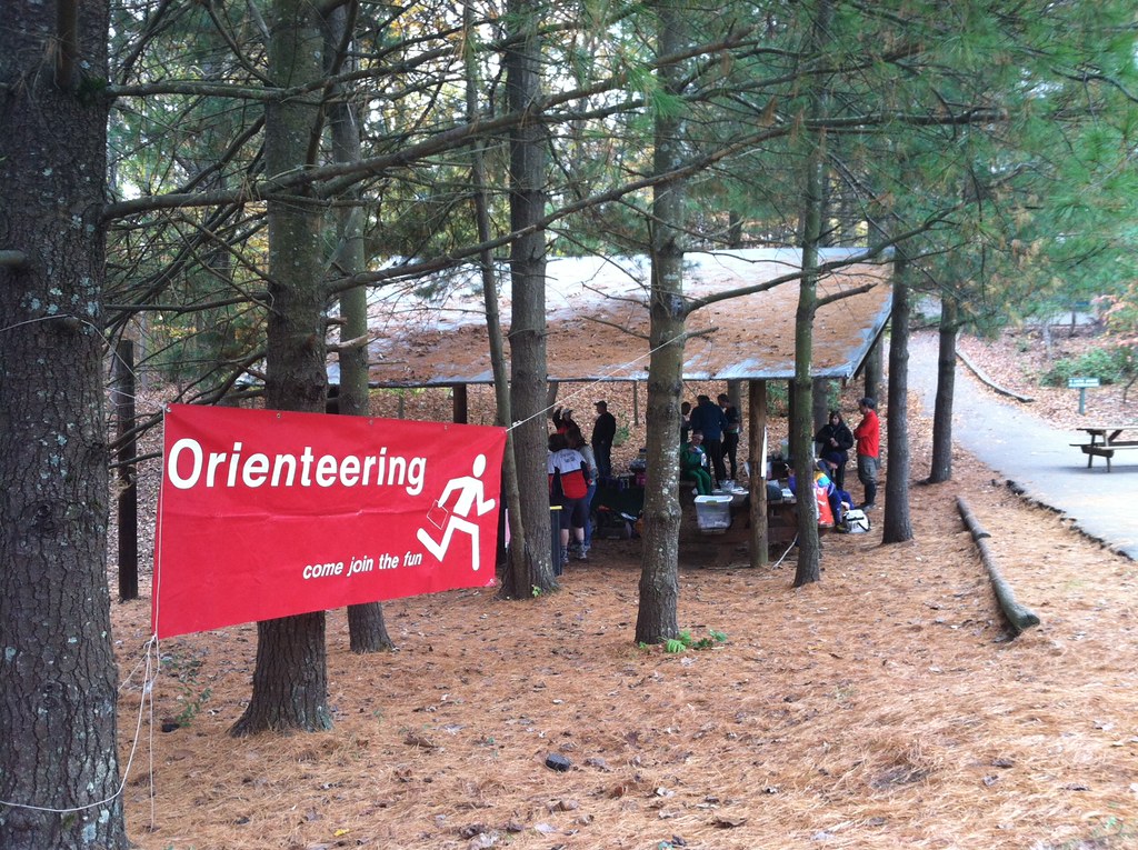
For the second consecutive year Quantico Orienteering Club had an orienteering meet in the Swanson Road Natural Area. Once again I was the meet director. On the whole I think this year's meet went well. The weather was much nicer and we had a significantly bigger turn out than last year. My biggest task leading up to the meet was recruiting people to help run the event. I wasn't completely successful in getting enough volunteers prior to the day of the meet but luckily some people stepped up at the meet to help out.
I bought more food this year than I did last year. In addition to lots of water, this year I bought 30 apples, 20 oranges, 4 one pound bags of pretzels, and 3 two pound packs of cookies. I was worried early in the day that I might have bought too much but by the end of the afternoon it was all gone.

Missteps
I may have focused a little too heavily on volunteer recruiting and buying supplies for this event. I feel as if I did not give enough time to other things like coordinating with the course designer and making sure I had everything I needed, like course notes. The course designer for the 2011 Swanson Road meet (who also happens to be the club's president) was much more pro-active than the one I was working with this year. Last year we communicated quite a bit in the week leading up to the event. That was not the case this year and I am at least partly to blame for the lack of communication.
Another area where I think I failed was in preparing the bulletin board that goes next to the registration table. It was sorely lacking in information. It should have included a copy of the meet announcement and the course notes. I did not press the course setter for course notes and he did not produce any. I also didn't realize that he wasn't going to be at the event until the night before when I was notified by one of the officers of the club. Still, I should have made a better effort to keep an open line of communication with the course setter, difficult as that might have been considering that he doesn't use e-mail and his only phone is a landline.
At the very least the bulletin board by the registration table should have included that following:
- a list of the courses offered (color, level of difficulty, control count, distance, elevation)
- a warning about areas of the map that need work (to put it politely)
- a warning about giving a wide berth to the Prince George's Radio Control Club's activities

The map
It needs some work. There are areas that are marked in white that aren't as open as the map would lead you to believe. There are also sections of the map, from what I have been told, where the contours are not representative of the actual terrain. If the map isn't updated by the next time it is used then, as indicated above, a warning should be posted for those who will be looking for controls in the areas where the map is known to be inaccurate.
A not so easy white course
The white course, one of the beginner level courses, was more difficult than it should have been. In order to find the 6th, 7th, and 8th controls on that course you needed to follow the telephone lines through some fairly thick undergrowth. I had one of the volunteers go out and place streamers through that section but that was after a number of people had attempted the course. Even with the streamers it still would have been a slog and quite difficult for anyone unfamiliar with orienteering or off-trail hiking.
Control pickup
Because the course designer wasn't at the meet I took care of organizing a group of volunteers for control pickup. I wasn't successful in getting enough volunteers for this task before the meet. One volunteer backed out at the last minute due to an injury he sustained while orienteering. In the end I managed to get five people to help me with control pickup.
After parceling out the controls I left myself with 10 controls to pickup. It took me about 70 minutes to find them all and lug them, plus two gallons of water, back to the start. During that stretch I also collected roughly half of the streamers that one of the volunteers put out for the white course. I didn't get to see all of the park but it was nice to see more than just the area surrounding the start/finish. According to my watch I walked about 2.75 miles.

While picking up controls I tripped over the remains of a barbed wire fence. I fell flat on my face but didn't sustain any injuries. When I got home I found a big tear in one of my shoes that wasn't there before; must have been the wire fence I tripped over. I'm glad I was wearing an old pair of shoes.
End of the day confusion
We had a little bit of drama after I got back from control pickup. We thought that one of the volunteers was still out looking for controls. We came to that conclusion because the control boxes he was supposed to pickup were missing. A couple people drove out to look for him. About ten minutes later we discovered that we had the missing flags but not the control boxes. After a couple phone calls, including one to the search party, we concluded that the missing control boxes must be in a bag that some else took home with them. This was confirmed later in the evening by e-mail.
Link: Swanson Road Results
Monday, October 1, 2012
Meadowood - Sep 30, 2012
View Dave Goes Orienteering 2012-13 in a larger map
I was supposed to help set up before the o-meet. I arrived 10 minutes later than I was supposed to be there, 50 minutes before the meet was due to begin. There were already 15-20 people there waiting to orienteer in addition to the folks setting up the meet. There wasn't much for me to do at that point so after standing around for a half hour or more I paid my event fee and did a course.
Meadowood has always been a challenge for me, and others. Part of the problem is that the map isn't as good as it could or should be. The club has yet to get the sort of data it needs to update the map. In particular there are trails and contours missing from the map. On most (if not all) of the advanced courses I'm sure that made a difference. I know that I felt it on the blue course.
The first time I had problems that I would attribute to the map was when I was searching for control 4/126. There was at least one re-entrant which I mistook for the entrant that the control was just above. I spent a few minutes searching it before deciding that it must be an unmapped feature. When I did find the control it was because I was following a trail which was mapped.
Control 7/101 seems to have been placed on the wrong root stock. There were two of them marked on the map. The map indicates that it should have been on the northern one but instead it was on the southern one. This gave me a little bit of trouble. I circled around for a little while before I found it with a little help from a couple other people who found it first.
Control 8/109 was not misplaced but I did a poor job when it came to finding it. I got in the general area and then tried cutting cross country instead of following a trail. When I did eventually find it was because I relented and took a trail.
Control 11/115 probably shouldn't have given me as much trouble as it did. I wasn't low enough into the re-entrant when I started looking for it. First I walked southeast along the re-entrant, then I tried heading northwest, and finally southeast again. Each time I got a little closer to the center of the re-entrant and on the third try, just as I was starting to get desperate, I found the control.
Control 13/129 wasn't easy to find. I knew that it was north of the trail I used to get in the general area of the control. What I couldn't figure out was where I should leave the trail and head north. I ended up much further west than I needed to go. When I started to head back east I wasn't sure where I was in relation to the control. I wandered a bit, got lucky and little bit of help from another orienteer.
The map is one of the key tools that orienteers use. When a map is as inaccurate as the Meadowood map is it shakes my confidence in it and my own abilities. There is no backup system for the map. What I end up doing is trying to figure out where the map is accurate. This usually adds to the time it takes me to find controls. Such was the case today.
On the plus side the weather was gorgeous. It was a little warm but not too warm. On the down side the bugs were out in full force and I came home with lots of little bites.


I stuck around after the meet to help clean up. After that I went to dinner with Dan and Jon. We ate at Busboys and Poets in Shirlington. I had hummus; black beans, wild rice, and grilled chicken; and banana bread, white chocolate pudding.
Course: Blue [Controls: 18; 8.8 km; 235 m]
Time: 3:40:46 - WinSplits - RouteGadget - AttackPoint
Actual Distance: 14.01 km
Monday, September 24, 2012
Lake Needwood - Sep 23, 2012
View Dave Goes Orienteering 2012-13 in a larger map
This was my first orienteering event of any sort since the Beer Chase in early June. I probably should not have tried the Blue course but I did anyway. It was not an easy course but it wasn't extremely difficult either. I made my life difficult by making a number of silly mistakes. I was able to correct them but I probably lost 15 minutes due to a lack of concentration.
Here are some details:
I set my compass wrong when I left control 4/103. I should have set it to northwest, instead I set it to northeast. I knew something wasn't right when it looked like the golf course was in my path but it took me a minute or two to figure out exactly what I did wrong.
There is an unmapped re-entrant between controls 6/104 and 7/108. From past experience at Lake Needwood I knew the map wasn't perfect. I hesitated when I came across the unmapped re-entrant but realized very quickly that the west side of it wasn't the downhill I was looking for because I had not gone far enough from 6/104.
I got distracted a number of times by other people. One of those times was when I was looking for Control 10/107. I went right past it on the first attempt. It wasn't in plain sight but I might have found it on the first try if I had been paying closer attention to the terrain, in particular the slope just north of the creek I was walking along. When I saw a trail heading north up a re-entrant I knew that I had gone too far and needed to double back. I found the control without any trouble on the second attempt.
Control 21/148 - This one was very well hidden. I had to circle around once before I found it. Even then it was only with a little help from someone else who was more or less standing on it.
Control 22/149 - This one gave me even more trouble. Once again I got careless and wasn't reading the terrain as carefully as I should have. It wasn't until I had gone a ways past the control that I figured out that I must have gone too far. I doubled back and found the control on the second attempt without any trouble.
While traveling from 24/146 to 25/148 I made a couple mistakes. First, I could have sworn that I set my compass to northwest and was following it faithfully. Based on where I hit the road and the GPS data from my watch I headed west until I hit the road. I'm not sure how that happened but the evidence speaks for itself. When I got close to 25/148 I walked right past it. I couldn't have been more than 10 meters from it. I miscounted the re-entrants and thought I had one more to go. When I got to the road I knew I had made mistake, took another look at the map and doubled back. The control was exactly where it should have been and where I should have looked the first time around.
Anyhow, as usual I finished it last place although I was less than 4 minutes behind the person who finished just ahead of me. If I could have just avoided one of the many mistakes I made I might have not finished last. Despite the silliness, I am quite happy that I finished the course.
The weather was beautiful. No rain. The temperature was just cool enough.
I used my GPS watch for the first time for orienteering. It worked great; better than I did.
After the meet I had to pack up the meet kit in my car. It was a lot of stuff. I had to put the back seats down. I had help loading the car but I was on my own when it came to unloading. It took me about 10 trips and 30 minutes to move everything from my car into my apartment. In three weeks I will reverse the process, load up my car for the meet at Swanson Road which I will be meet directing for the second year in a row.
Course: Blue [Controls: 28; 9.2 km; 295 m]
Time: 3:27:57 - WinSplits - RouteGadget - AttackPoint
Actual Distance Walked: 13.33 km
Subscribe to:
Posts (Atom)