Monday, October 29, 2012

Hemlock Overlook - Oct 28, 2012


View Dave Goes Orienteering 2012-13 in a larger map

I had a fairly good day of orienteering at Hemlock Overlook. I made one glaring error but aside from that I think I did a pretty good job. I've had problems at this park in the past, which for the most part I think are due to the fact that the map isn't complete. There are missing contours in places which can lead one to believe that they have found the right terrain feature when actually there are more of them in reality than there are depicted on the map.

I made my glaring error of when I left control 3/114. I should have headed southwest but instead I headed southeast. I had gone a couple hundred meters or more before I figured out why the terrain I was looking at looked nothing like what I was expecting to see. I think I got distracted when I left 3/114 by another orienteer.

Some of the trails should have been marked as broken up. In particular the trail leading northeast from 7/132 was overgrown with all sorts of vegetation. In places the trail seemed to disappear altogether but then reappear 10 meters later.

I found most of the controls on the first attempt.

Control 15/124 was in a hole in the ground but the hole was flagged with a pink streamer which kind of gave it away.

I drifted off course when searching for control 17/119 and instead wound up at 14/142. From there it was easy enough to make my way to 17/119 which was due north of 14/142.

I got thrown off a little when searching for 19/110 because some of the trails were less distinct in reality than they were on the map. I eventually ran across 3/114 and was easily able to navigate to 19/110 from there. Based on these experiences it seems that one advantage to doing the blue course in a smaller park like Hemlock Overlook is that there are more opportunities that usual to use other controls on the course to help navigate to the one you are looking for.

All in all the weather was perfect. The rain held off until well after 3 PM. I didn't see any until after 5 PM but by that time I was several miles from the Hemlock Overlook.

After orienteering I had an early dinner at Loving Hut, a vegan Vietnamese restaurant in Falls Church with Dan and Jon. The food was excellent.


Course: Blue [Controls 20; 9.1 km; 350 m]
Time: 2:50:29 - Winsplits - RouteGadget - AttackPoint
Actual Distance: 10.75 km


Thursday, October 18, 2012

Swanson Road - Oct 14, 2012


View Dave Goes Orienteering 2012-13 in a larger map

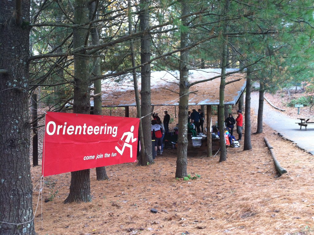
For the second consecutive year Quantico Orienteering Club had an orienteering meet in the Swanson Road Natural Area. Once again I was the meet director. On the whole I think this year's meet went well. The weather was much nicer and we had a significantly bigger turn out than last year. My biggest task leading up to the meet was recruiting people to help run the event. I wasn't completely successful in getting enough volunteers prior to the day of the meet but luckily some people stepped up at the meet to help out.

I bought more food this year than I did last year. In addition to lots of water, this year I bought 30 apples, 20 oranges, 4 one pound bags of pretzels, and 3 two pound packs of cookies. I was worried early in the day that I might have bought too much but by the end of the afternoon it was all gone.


Missteps

I may have focused a little too heavily on volunteer recruiting and buying supplies for this event. I feel as if I did not give enough time to other things like coordinating with the course designer and making sure I had everything I needed, like course notes. The course designer for the 2011 Swanson Road meet (who also happens to be the club's president) was much more pro-active than the one I was working with this year. Last year we communicated quite a bit in the week leading up to the event. That was not the case this year and I am at least partly to blame for the lack of communication.

Another area where I think I failed was in preparing the bulletin board that goes next to the registration table. It was sorely lacking in information. It should have included a copy of the meet announcement and the course notes. I did not press the course setter for course notes and he did not produce any. I also didn't realize that he wasn't going to be at the event until the night before when I was notified by one of the officers of the club. Still, I should have made a better effort to keep an open line of communication with the course setter, difficult as that might have been considering that he doesn't use e-mail and his only phone is a landline.

At the very least the bulletin board by the registration table should have included that following:
- a list of the courses offered (color, level of difficulty, control count, distance, elevation)
- a warning about areas of the map that need work (to put it politely)
- a warning about giving a wide berth to the Prince George's Radio Control Club's activities


The map

It needs some work. There are areas that are marked in white that aren't as open as the map would lead you to believe. There are also sections of the map, from what I have been told, where the contours are not representative of the actual terrain. If the map isn't updated by the next time it is used then, as indicated above, a warning should be posted for those who will be looking for controls in the areas where the map is known to be inaccurate.


A not so easy white course

The white course, one of the beginner level courses, was more difficult than it should have been. In order to find the 6th, 7th, and 8th controls on that course you needed to follow the telephone lines through some fairly thick undergrowth. I had one of the volunteers go out and place streamers through that section but that was after a number of people had attempted the course. Even with the streamers it still would have been a slog and quite difficult for anyone unfamiliar with orienteering or off-trail hiking.


Control pickup

Because the course designer wasn't at the meet I took care of organizing a group of volunteers for control pickup. I wasn't successful in getting enough volunteers for this task before the meet. One volunteer backed out at the last minute due to an injury he sustained while orienteering. In the end I managed to get five people to help me with control pickup.

After parceling out the controls I left myself with 10 controls to pickup. It took me about 70 minutes to find them all and lug them, plus two gallons of water, back to the start. During that stretch I also collected roughly half of the streamers that one of the volunteers put out for the white course. I didn't get to see all of the park but it was nice to see more than just the area surrounding the start/finish. According to my watch I walked about 2.75 miles.


While picking up controls I tripped over the remains of a barbed wire fence. I fell flat on my face but didn't sustain any injuries. When I got home I found a big tear in one of my shoes that wasn't there before; must have been the wire fence I tripped over. I'm glad I was wearing an old pair of shoes.


End of the day confusion

We had a little bit of drama after I got back from control pickup. We thought that one of the volunteers was still out looking for controls. We came to that conclusion because the control boxes he was supposed to pickup were missing. A couple people drove out to look for him. About ten minutes later we discovered that we had the missing flags but not the control boxes. After a couple phone calls, including one to the search party, we concluded that the missing control boxes must be in a bag that some else took home with them. This was confirmed later in the evening by e-mail.


Monday, October 1, 2012

Meadowood - Sep 30, 2012


View Dave Goes Orienteering 2012-13 in a larger map

I was supposed to help set up before the o-meet. I arrived 10 minutes later than I was supposed to be there, 50 minutes before the meet was due to begin. There were already 15-20 people there waiting to orienteer in addition to the folks setting up the meet. There wasn't much for me to do at that point so after standing around for a half hour or more I paid my event fee and did a course.

Meadowood has always been a challenge for me, and others. Part of the problem is that the map isn't as good as it could or should be. The club has yet to get the sort of data it needs to update the map. In particular there are trails and contours missing from the map. On most (if not all) of the advanced courses I'm sure that made a difference. I know that I felt it on the blue course.

The first time I had problems that I would attribute to the map was when I was searching for control 4/126. There was at least one re-entrant which I mistook for the entrant that the control was just above. I spent a few minutes searching it before deciding that it must be an unmapped feature. When I did find the control it was because I was following a trail which was mapped.

Control 7/101 seems to have been placed on the wrong root stock. There were two of them marked on the map. The map indicates that it should have been on the northern one but instead it was on the southern one. This gave me a little bit of trouble. I circled around for a little while before I found it with a little help from a couple other people who found it first.

Control 8/109 was not misplaced but I did a poor job when it came to finding it. I got in the general area and then tried cutting cross country instead of following a trail. When I did eventually find it was because I relented and took a trail.

Control 11/115 probably shouldn't have given me as much trouble as it did. I wasn't low enough into the re-entrant when I started looking for it. First I walked southeast along the re-entrant, then I tried heading northwest, and finally southeast again. Each time I got a little closer to the center of the re-entrant and on the third try, just as I was starting to get desperate, I found the control.

Control 13/129 wasn't easy to find. I knew that it was north of the trail I used to get in the general area of the control. What I couldn't figure out was where I should leave the trail and head north. I ended up much further west than I needed to go. When I started to head back east I wasn't sure where I was in relation to the control. I wandered a bit, got lucky and little bit of help from another orienteer.

The map is one of the key tools that orienteers use. When a map is as inaccurate as the Meadowood map is it shakes my confidence in it and my own abilities. There is no backup system for the map. What I end up doing is trying to figure out where the map is accurate. This usually adds to the time it takes me to find controls. Such was the case today.

On the plus side the weather was gorgeous. It was a little warm but not too warm. On the down side the bugs were out in full force and I came home with lots of little bites.


I stuck around after the meet to help clean up. After that I went to dinner with Dan and Jon. We ate at Busboys and Poets in Shirlington. I had hummus; black beans, wild rice, and grilled chicken; and banana bread, white chocolate pudding.

Course: Blue [Controls: 18; 8.8 km; 235 m]
Time: 3:40:46 - WinSplits - RouteGadget - AttackPoint
Actual Distance: 14.01 km

Monday, September 24, 2012

Lake Needwood - Sep 23, 2012


View Dave Goes Orienteering 2012-13 in a larger map

This was my first orienteering event of any sort since the Beer Chase in early June. I probably should not have tried the Blue course but I did anyway. It was not an easy course but it wasn't extremely difficult either. I made my life difficult by making a number of silly mistakes. I was able to correct them but I probably lost 15 minutes due to a lack of concentration.

Here are some details:

I set my compass wrong when I left control 4/103. I should have set it to northwest, instead I set it to northeast. I knew something wasn't right when it looked like the golf course was in my path but it took me a minute or two to figure out exactly what I did wrong.

There is an unmapped re-entrant between controls 6/104 and 7/108. From past experience at Lake Needwood I knew the map wasn't perfect. I hesitated when I came across the unmapped re-entrant but realized very quickly that the west side of it wasn't the downhill I was looking for because I had not gone far enough from 6/104.

I got distracted a number of times by other people. One of those times was when I was looking for Control 10/107. I went right past it on the first attempt. It  wasn't in plain sight but I might have found it on the first try if I had been paying closer attention to the terrain, in particular the slope just north of the creek I was walking along. When I saw a trail heading north up a re-entrant I knew that I had gone too far and needed to double back. I found the control without any trouble on the second attempt.

Control 21/148 - This one was very well hidden. I had to circle around once before I found it. Even then it was only with a little help from someone else who was more or less standing on it.

Control 22/149 - This one gave me even more trouble. Once again I got careless and wasn't reading the terrain as carefully as I should have. It wasn't until I had gone a ways past the control that I figured out that I must have gone too far. I doubled back and found the control on the second attempt without any trouble.

While traveling from 24/146 to 25/148 I made a couple mistakes. First, I could have sworn that I set my compass to northwest and was following it faithfully. Based on where I hit the road and the GPS data from my watch I headed west until I hit the road. I'm not sure how that happened but the evidence speaks for itself. When I got close to 25/148 I walked right past it. I couldn't have been more than 10 meters from it. I miscounted the re-entrants and thought I had one more to go. When I got to the road I knew I had made mistake, took another look at the map and doubled back. The control was exactly where it should have been and where I should have looked the first time around.

Anyhow, as usual I finished it last place although I was less than 4 minutes behind the person who finished just ahead of me. If I could have just avoided one of the many mistakes I made I might have not finished last. Despite the silliness, I am quite happy that I finished the course.

The weather was beautiful. No rain. The temperature was just cool enough.

I used my GPS watch for the first time for orienteering. It worked great; better than I did.

After the meet I had to pack up the meet kit in my car. It was a lot of stuff. I had to put the back seats down. I had help loading the car but I was on my own when it came to unloading. It took me about 10 trips and 30 minutes to move everything from my car into my apartment. In three weeks I will reverse the process, load up my car for the meet at Swanson Road which I will be meet directing for the second year in a row.

Course: Blue [Controls: 28; 9.2 km; 295 m]
Time: 3:27:57 - WinSplits - RouteGadget - AttackPoint
Actual Distance Walked: 13.33 km

Tuesday, September 4, 2012

Vacation Plans - Mar 2013

I've started to plan a vacation in Ontario which will include a couple days of hiking. I've found some trail maps on the Internet for a couple long hikes that are both within a couple hours drive to Toronto.

My biggest concern is the weather. I want to go in mid-March and the weather can be a bit unpredictable at that time of year. Provided there isn't heavy snowfall just prior to or during my trip I think I should be okay. I can deal with some snow or hiking in snow, provided it isn't too deep and the trail is well marked.

Wednesday, August 29, 2012

Walking Health - Aug 29, 2012

I really need to be more careful with my feet. I learned a lesson last weekend about wearing boots that are too snug on a long hike. Here's hoping that I will put that information to good use.

I'm still undecided as to whether I should attempt to do the very long walk from Takoma Park to Shirlington and then back to Takoma Park this weekend. My feet are feeling better but the blisters are still there.

Despite the blisters I have gotten back to walking to the Metro from the office and from home. I've logged over 10 miles since yesterday morning. So far so good but am I ready to walk 32+ miles? I dunno.

Tuesday, August 28, 2012

Weekend Hike - Aug 26, 2012

I went for my longest hike yet this past Sunday: 29 miles. I'm still a sore from it. The parts that hurts the most are my feet. That is due in large part to the boots I decided to wear. My Merrell boots area medium width. I need to be wearing a wide-sized boot.

I didn't wear my Columbia boots (which are wide-sized) because I thought there was going to be a lot of rain today. I wore them last week when it rained for the last 1.5 hours of my hike and those boots got waterlogged fairly quickly. It didn't rain this week but I came home with a couple blisters.

Aside from that it was a fine walk. I was pretty exhausted by the time I got home. It took me just over 8 hours to complete the walk. Most of it was on paved trails but there was a section in the middle that lasted for 6-7 miles that was unpaved.

I'm undecided at this point as to whether I should go through with my plans to walk from Takoma Park to Shirlington and back next weekend. Once again I think that I will play it by ear and see how I am feeling, in particular how my feet are feeling when next weekend rolls around.

I ate breakfast (oatmeal and a slice of pumpernickel raisin) before I left. While hiking I nibbled at a ProBar. That one ProBar was all I had to eat during the hike. I drank some water but not a lot. I think I need to start taking more to eat than just ProBars. I'm thinking pretzels would be a good idea and maybe some tuna fish.